Wednesday, January 30, 2013

GoAnimate Movie & Essential Questions

bythometry by mickeylab98 on GoAnimate

Video Maker - Powered by GoAnimate.bythometry by mickeylab98 on GoAnimate
Video Maker - Powered by GoAnimate.

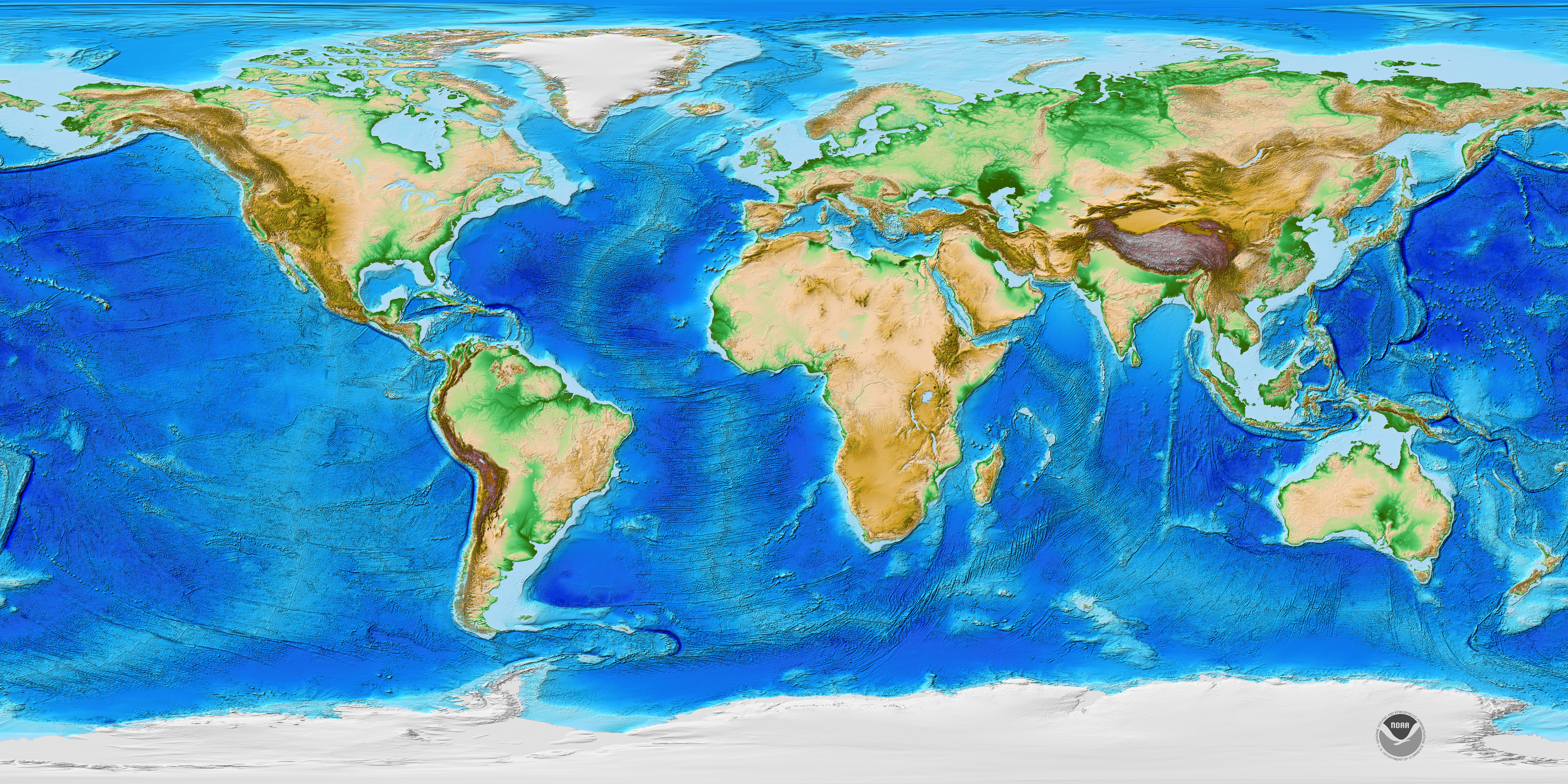
1.Bathymetry is the measurement of the depth of water in oceans, rivers, or lakes. Bythametric maps use line to show the shape & elevation of land features. On topographic maps, lines connect points of equal elevation & points of equal depth.

2. In ancient times, they measured the depth with a heavy rope, however they were inaccurate & incomplete.

3. Now echo sounders are used to make bathymetric measurements, the time it takes for the sound wave to come back, the deeper the water. The accuracy is limited and sometimes inaccurate.

4. Multibeam echosounders are more effective because they provide angular resolution,, the ability to measure different angles. Meaning a single feature for the seafloor.

5. Many things have been discovered thanks to bathymetric technology, for example, thousands of seamounts were discovered in the central Pacific Ocean.

6. Bathymetric measurements support safe navigation & protect marine environments. They can predict strengths of tsunamis.


Monday, January 28, 2013

Mid-Term Exam Reflection

Taking this Marine Science Exam Final taught me to be extra careful when taking exams no matter how confident I am about the material. I did not realize that I had skipped a question I knew the answer to until I got my test back. Skipping this question made me realize that it is important to go back and revise your test once you are done, in order to get the best score possible. I was in shock when I got my test back and realized that I skipped a question because that is something that I usually never do. Skipping this question could have been catastrophic because I could have started marking down the correct answers for the wrong questions. Although this was a possibility, it could have all been avoided by going back and revising my test.


Monday, January 21, 2013

pg. 97-112 Questions/ Acrostic Poem

Answer #1:
         First carried out by Posidonius with a rope and a rock. then they started using sound pulses or echo sounders. Now scientists use multibeam echo sounder systems & satellite altimetry.
#2:
         We would be able to locate an active margin around the Pacific. We can locate a passive margin on the Atlantic.
#3:
         A shallow, nearly flat continental shelf close to shore. Slope seaward which is steeply sloped. Continental rise, an apron of sediment that blends the continental margins into the deep-ocean basins.


Acrostic Poem: Continental Margins

Continental
Oceans
Nearly
Trap
Inhibit
Never
Escaping
No
The
Atlantis
Land
Margins
Across
Reefs
Grow
Idle
Never
Stopping